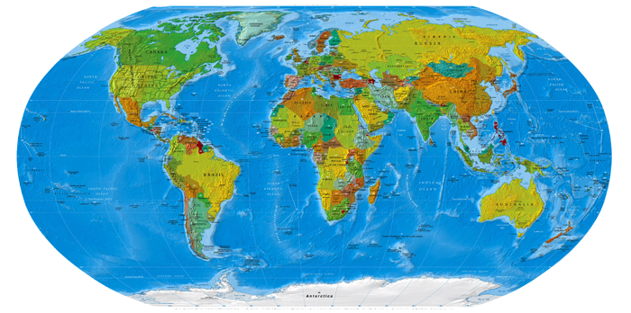
Карты Полярных регионов и Океанов Перри-Кастанеда
Библиотека карт Перри-Кастанеда (более 250 000 карт онлайн)

Библиотека карт Перри-Кастанеда включает в себя более 250 000 карт онлайн.
Библиотека Университета Техас.
Polar Regions and Oceans Maps
Antarctic Region
- Antarctica (Small Map) 2014 (9.8K)
- Antarctic Region (Political) 2009 (621K) [pdf format]
- Antarctic Region (Political) 2005 (1.3MB) [pdf format]
- Antarctic Region (Political) 2002 (206K) [jpeg format]
- Antarctic Region (Political) 2002 (207K) [pdf format]
- Antarctic Region (Political) 2001 (223K) [jpeg format]
- Antarctic Region (Political) 2001 (1.1MB) [pdf format]
- Antarctic Region (Political) 2000 (280K) [jpeg format]
- Antarctic Region (Political) 2000 (769K) [pdf format]
- Antarctic Region (Political) 1999 (162K) [jpeg format]
- Antarctic Region (Political) 1999 (162K) [pdf format]
- Antarctic Region (Political) 1998 (387K) [jpeg format]
- Antarctic Region (Political) 1998 (332K) [pdf format]
- Antarctic Region (Political) 1997 (374K) [jpeg format]
- Antarctic Region (Political) 1997 (1MB) [pdf format]
- Antarctic Region (Political) 1995 (213K) [jpeg format]
- Antarctic Region (Political) 1995 (216K) [pdf format]
- Antarctica - Global Navigation and Planning Chart, Sheet G-26 1:5,000,000, Defense Mapping Agency Aerospace Center, Compiled 1970, Revised 1985 (19MB) This map includes all of Antarctica
- Antarctica - Global Navigation and Planning Chart, Sheet G-24 1:5,000,000, Defense Mapping Agency Aerospace Center, Compiled 1970 (16.4MB) This map includes parts of Antarctica and Southern South America
- Antarctica - Jet Navigation Chart, Sheet JNC-117N 1:2,000,000, Defense Mapping Agency Aerospace Center, Compiled 1974 (15.1MB) This map includes most of the Antarctic Peninsula, Palmer Land and parts of Southern South America
- Antarctica - Jet Naviation Chart, Sheet JNC-120 1:2,000,000 Defense Mapping Agnecy Aerospace Center, Compiled 1975 (17.6MB) This map includes the Antarctic Peninsula
- Antarctica - Jet Navigation Chart, Sheet JNC-121 1:2,000,000, Defense Mapping Agency Aerospace Center, Complied 1975 (14.6MB)
- Antarctica - Jet Navigation Chart, Sheet JNC-122 1:2,000,000, Defense Mapping Agency Aerospace Center, Complied 1975 (15.2MB)
- Antarctica - Jet Navigation Chart, Sheet JNC-123 1:2,000,000, Defense Mapping Agency Aerospace Center, Complied 1975 (13.7MB)
- Antarctica - Jet Navigation Chart, Sheet JNC-124 1:2,000,000, Defense Mapping Agency Aerospace Center, Complied 1975 (17.3MB)
- Antarctica - Jet Navigation Chart, Sheet JNC-125 1:2,000,000, Defense Mapping Agency Aerospace Center, Complied 1975 (12.2MB)
- Antarctica - Research Stations and Territorial Claims (Shaded Relief) 1986 (387K) and pdf format (407K)
- Antarctica - South Pole Aerial View from Amundsen-Scott South Pole Station, Antarctica Photomap original scale approx. 1:1250 U.S.G.S. 1983 (758K)
- South Atlantic Ocean Islands (Political) 1978 (172K)
- Southern Ocean (Small Map) 2014 (19K)
Arctic Region
- Arctic Ocean (Small Map) 2014 (28K)
- Arctic Region (Political) 2012 (5.5MB) [pdf format]
- Arctic Region (Political) 2007 (812K) [jpeg format]
- Arctic Region (Political) 2007 (489K) [pdf format]
- Arctic Region (Political) 2002 (264K) [jpeg format]
- Arctic Region (Political) 2002 (263K) [pdf format]
- Arctic Region (Political) 2001 (241K) [jpeg format]
- Arctic Region (Political) 2001 (898K) [pdf format]
- Arctic Region (Political) 2000 (314K) [jpeg format]
- Arctic Region (Political) 2000 (945K) [pdf format]
- Arctic Region (Political) 1999 (197K) [jpeg format]
- Arctic Region (Political) 1999 (162K) [pdf format]
- Arctic Region (Political) 1997 (2.2MB) [pdf format]
- Arctic Region (Political) 1995 (285K) [jpeg format]
- Arctic Region (Political) 1995 (288K) [pdf format]
- Arctic Region (Political) 1987 (280K) [jpeg format]
- Arctic Region (Political) 1987 (281K) [pdf format]
- Arctic Region (Shaded Relief) 2009 (1.6MB) [pdf format]
- Arctic Region (Wall Map) 2008 (7.9MB) [jpeg format]
- Arctic Region - Operational Navigation Chart Series 1:1,000,000, U.S. Defense Mapping Agency Aerospace Center
- Arctic Region - Tactical Pilotage Chart Series 1:500,000, U.S. Defense Mapping Agency Aerospace Center
- Arctic Region - Russian Claimed Territory in Arctic Ocean from The Joint Operating Environment [page 34], U.S. Joint Forces Command, 2008 (220K)
- Greenland (Political) 1976 (182K) [jpeg format]
- Greenland (Political) 1976 (185K) [pdf format]
- Greenland (Small Map) 2014 (36K)
- Jan Mayen (Norway) (Small Map) 2014 (14K)
- Svalbard (Norway) (Small Map) 2014 (16K)
Atlantic Ocean
- Atlantic Ocean (Small Map) 2014 (27K)
- Azores (Portugal) (Shaded Relief) 1975 (146K)
- Bahamas (Shaded Relief) 1986 (271K)
- Bahamas (Small Map) 2014 (13K)
- Bermuda (Political) 1976 (325K)
- Bermuda (Small Map) 2014 (11K)
- Bouvet Island (Norway) (Small Map) 2014 (6K)
- Canary Islands Maps
- Cape Verde Maps
- Caribbean Islands Maps see Americas
- Falkland Islands (Shaded Relief) (177K)
- Falkland Islands (Small Map) 2014 (11K)
- Faroe Islands (Denmark) (Small Map) 2014 (11K)
- Greenland (Political) 1976 (182K)
- Greenland (Small Map) 2014 (36K)
- Iceland (Political) 1981 (133K)
- Iceland (Shaded Relief) 1981 (206K)
- Iceland (Small Map) 2014 (18K)
- Islands Off Brazil Nautical chart (Not for Navigational Use). U.S. National Imagery and Mapping Agency, Chart 24521, 1998. Includes: Approaches to Atol das Rocas, 1:100,000; Penedos de Sao Pedro e Sao Paulo, 1:10,000; Atol das Rocas, 1:20,000; Approaches to Penedos de Sao Pedro e Sao Paulo, 1:30,000 (2.1 MB)
- Jan Mayen (Norway) (Small Map) 2014 (14K)
- Madeira Maps
- Saint Helena (with Ascension Island, Tristan da Cunha) (Small Map) 2014 (20K)
- St. Peter and St. Paul Rocks (Penedos De Sao Pedro e Sao Paulo) Nautical chart Not for Navigational Use Original scale 1:10,000. Portion of Islands Off Brazil, Chart 24521, U.S. National Imagery and Mapping Agency, 1998 (288K)
- South Atlantic Ocean Islands (Political) 1978 (172K)
- South Georgia Original scale 1:200,000. Directorate of Overseas Surveys, D.O.S. 610, 1958 (3.6MB)
- South Georgia and the South Sandwich Islands (U.K.) (Small Map) 2014 (7K)
- Svalbard (Norway) (Small Map) 2014 (16K)
Indian Ocean
- Indian Ocean Maps Collection (More than 50 maps)
Pacific Ocean
- Australia and the Pacific Maps Collection
Created/Updated: 25.05.2018
 |
|